


Page 15 - An Overview of Penghu
P. 15
I        Geography and Climate


                                             Location

                                                  Penghu Prefecture consists of 63 islands scattered across the southern
                                             Taiwan Strait, between 119°18'E to 119°43'E and 23°10'N to 23°50'N. On its
                                             east, Taiwan can be seen sitting across the other side of Penghu Waterway.
                                             The  shortest  distance  between  the  main  island  of Taiwan  and  Penghu  is  24
                                             nautical  miles  (74  nautical  miles  from  Magong  to  Kaohsiung,  52  nautical
                                             miles  to Anping,  and  195  nautical  miles  to  Keelung).    On  its  west,  Fujian
                                             Province sits across the Taiwan Strait, and the shortest distance between the
                                             two  is  75  nautical  miles  (95  nautical  miles  from  Magong  to  Xiamen).  The
                                             Northern Tropic cuts right through the center of Penghu Archipelago. (Note: 1
                                             nautical mile equals 1.852 kilometers.)


                                             Terrain

                                                  The terrains of the many islands of the Penghu Archipelago do not vary
                                             much,  with  most  characterized  by  flat  low  lands. The  average  altitude  falls
                                             between 50 and 60 feet, and there is barely anything that can be identified as
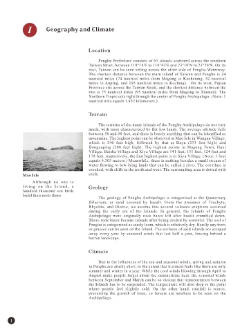
                                             mountains. The highest point can be observed at Mao Isle in Wangan Village,
                                             which  is  240  feet  high,  followed  by  that  at  Dayu  (233  feet  high)  and
                                             Dongyuping  (200  feet  high).  The  highest  points  in  Magong  Town,  Huxi
                                             Village, Baisha Village and Xiyu Village are 141 feet, 151 feet, 124 feet and
                                             178 feet, respectively; the first highest point is in Xiyu Village. (Note: 1 foot
                                             equals 0.303 meters.) Meanwhile, there is nothing besides a small stream of
                                             water flowing to low-lying lands that can be called a river. The coastline is
                                             crooked, with cliffs in the north and west. The surrounding area is dotted with
            Mao Isle                         reefs.
                 Although  no  one  is
            living  on  the  Island,  a      Geology
            hundred  thousand  sea  birds
            build their nests there.
                                                  The  geology  of  Penghu Archipelago  is  categorized  as  the  Quaternary
                                             Diluvium,  or  sand  covered  by  basalt.  From  the  presence  of  Trachyte,
                                             Rhyolite,  and  Diorite,  we  assume  that  several  volcanic  eruptions  occurred
                                             during  the  early  era  of  the  Islands.  In  general,  the  Islands  of  Penghu
                                             Archipelago  were  originally  rock  bases  left  after  basalt  crumbled  down.
                                             Those rock bases became islands after being eroded by seawater. The soil of
                                             Penghu is categorized as sandy loam, which is relatively dry. Hardly any trees
                                             or grasses can be seen on the Island. The surfaces of said islands are scraped
                                             away  every  year  by  seasonal  winds  that  last  half  a  year,  leaving  behind  a
                                             barren landscape.


                                             Climate


                                                  Due to the influences of the sea and seasonal winds, spring and autumn
                                             in Penghu are utterly short, to the extent that it almost feels like there are only
                                             summer and winter in a year. While the cool winds blowing through April to
                                             August  make  people  forget  about  the  summertime  heat,  the  seasonal  winds
                                             between September and March can be so vicious that transportation between
                                             the Islands has to be suspended. The temperature will also drop to the point
                                             where  people  feel  slightly  cold.  On  the  other  hand,  rainfall  is  scarce,
                                             preventing  the  growth  of  trees,  so  forests  are  nowhere  to  be  seen  on  the
                                             Archipelago.


      1

