


Page 16 - 澎湖海洋地質公園-文化與旅遊篇
P. 16
澎湖海洋地質公園 PENGHU MARINE GEOPARK                               文化與旅遊篇         Culture & Travel Volume


 澎湖地質公園的設置與經營管理方向

 澎湖先期規劃6處地質公園

 澎湖各島嶼中列為優先設置地質公園的島嶼有6處,  3.白沙鄉吉貝嶼地質公園:
 散佈在本島上及群島的北海、東海、及南海海域  下部為覆蓋紅土的矽質玄武岩,上部則是距今約
 內。6處地質公園在地形方面涵蓋了近期豐富的陸  15-14百萬年前形成的玄武岩。
 地、海岸侵蝕與沉積作用產生的多樣化地形,也使
 千萬年來多樣的火山活動特徵得以呈現。  4.西嶼鄉小門嶼地質公園:

 1.馬公市桶盤嶼地質公園:  主要由兩層矽質玄武岩構成,下層年代約為距今
 15-14百萬年前以上,上層為距今約11-10百萬年
 是由兩層矽質玄武岩夾沉積岩構成的,覆蓋於方  前。兩層玄武岩中間夾的是淺水相的泥質與凝灰
 山頂面的矽質玄武岩形成於距今11-10百萬年前,  岩質沉積岩,其中泥岩中含有化石和生痕化石。
 下部的玄武岩推測形成於距今15-14百萬年前,兩
 層矽質玄武岩中間所夾的是淺水沉積的沉積岩。  5.望安地質公園:

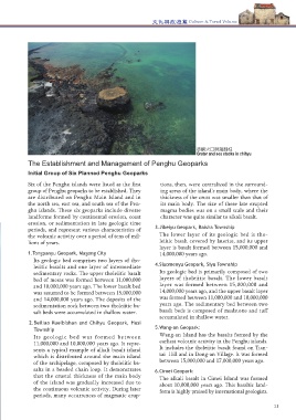
 2.湖西鄉北寮奎壁山、赤嶼地質公園:  望安嶼有澎湖群島最早期火山活動形成的玄武                                       赤嶼火口與海蝕柱
                                                                                Grater and sea stacks in chihyu
 岩,包括在天台山和東安村可見的含有矽質玄武
 形成於距今約11-10百萬年前,是澎湖地區的鹼性  岩,形成年代均約距今15-17百萬年。  The Establishment and Management of Penghu Geoparks
 玄武岩體,呈鏈珠般分布於矽質玄武岩構成的群
 島主體周圍的典型實例,可以顯示島嶼主體因持  6.七美地質公園:  Initial Group of Six Planned Penghu Geoparks
 續火山活動而地殼厚度逐漸增加,以致於後期岩  七美嶼的鹼性玄武岩大約生成於距今10百萬年  Six of the Penghu islands were listed as the first   tions, then, were centralized in the surround-
 漿噴發多集中於地殼較薄的島嶼主體周圍、岩漿  前,是國際地質學者非常稱讚的玄武岩地形。  group of Penghu geoparks to be established. They   ing areas of the island’s main body, where the
 體規模較小且特性趨近於鹼性玄武岩質。  are distributed on Penghu Main Island and in   thickness of the crust was smaller than that of
            the north sea, east sea, and south sea of the Pen-    its main body. The size of these late erupted
            ghu islands. These six geoparks include diverse       magma bodies was on a small scale and their
            landforms formed by continental erosion, coast        character was quite similar to alkali basalt.
            erosion, or sedimentation in late geologic time
            periods, and represent various characteristics of   3.Jibeiyu Geopark, Baisha Township
            the volcanic activity over a period of tens of mil-  The lower layer of its geologic bed is tho-
            lions of years.                                      leiitic basalt covered by laterite, and its upper
                                                                 layer is basalt formed between 15,000,000 and
            1.Tongpanyu Geopark, Magong City                     14,000,000 years ago.
               Its geologic bed comprises two layers of tho-
               leiitic basalts and one layer of intermediate   4.Siaomenyu Geopark, Siyu Township
               sedimentary rocks. The upper tholeiitic basalt    Its geologic bed is primarily composed of two
               bed of mesas was formed between 11,000,000        layers of tholeiitic basalt. The lower basalt
               and 10,000,000 years ago. The lower basalt bed    layer was formed between 15,000,000 and
               was assumed to be formed between 15,000,000       14,000,000 years ago, and the upper basalt layer
               and 14,000,000 years ago. The deposits of the     was formed between 11,000,000 and 10,000,000
               sedimentation rock between two tholeiitic ba-     years ago. The sedimentary bed between two
               salt beds were accumulated in shallow water.      basalt beds is composed of mudstone and tuff
                                                                 accumulated in shallow water.
             2.Beiliao Kueibishan and Chihyu Geopark, Husi
               Township                                        5.Wang-an Geopark:
               Its  geologic  bed  was  formed  between          Wang-an Island has the basalts formed by the
               11,000,000 and 10,000,000 years ago. It repre-    earliest volcanic activity in the Penghu islands.
               sents a typical example of alkali basalt island   It includes the tholeiitic basalt found on Tian-
               which is distributed around the main island       tai  Hill and in Dong-an Village. It was formed
               of the archipelago, composed by tholeiitic ba-    between 15,000,000 and 17,000,000 years ago.
               salts in a beaded chain loop. It demonstrates   6.Cimei Geopark:
               that the crustal thickness of the main body       The alkali basalt in Cimei Island was formed
               of the island was gradually increased due to      about 10,000,000 years ago. This basaltic land-
               the continuous volcanic activity. During later
 小門嶼           periods, many occurrences of magmatic erup-       form is highly praised by international geologists.
 燈塔
 Siaomenyu Geopark
 Lighthouse
 10 10                                                                                                         11

